Archaeologists at the University of Bradley are using data from the Earth’s magnetic field to discover ancient European settlements buried under the North Sea.
According to a report from the university, these scientists are specifically investigating Doggerland, a stretch of land that once connected mainland Europe with the eastern coast of Great Britain. National Geographic’s website explains that, approximately 12,000 years ago, what is now ocean was a series of sloping hills, marshland, wooded valleys and swamps.
The university already has a team dedicated to studying Doggerland; their project is entitled “Europe’s Lost Frontiers.” Both the Lost Frontiers data and National Geographic agree that humans once settled Doggerland based on evaluations of tools and other artifacts embedded in the sea floor.
Difficulty in data gathering
National Geographic’s website points out that a lot of the seismic data used by researchers comes from oil companies drilling in the North Sea.
Now, it is not oil companies but wind farms that archaeologists are competing with, according to the university report, and Ph.D. student Ben Urmston is on the case. He will be looking for anomalies in magnetic fields, which could indicate the presence of ancient remains. This will allow him and his colleagues to unearth new data without taking a dive into the North Sea.
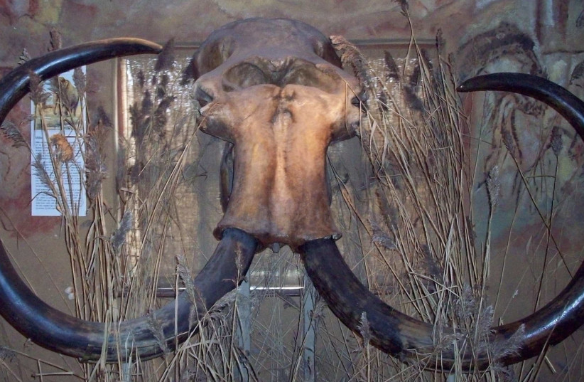
 Woolly mammoth skull discovered by fishermen in the North Sea, at Celtic and Prehistoric Museum, Ireland. (credit: Wikimedia Commons)
Magnetometry, the research method Urmston will be using, has thus far been primarily used for “terrestrial archaeologists,” and this will be one of the few attempts to use it to examine an underwater landscape.
Magnetic data, like seismic data, is collected by those looking to extract energy sources from the sea floor in order to map out the landscape for construction. Offshore wind farming companies, according to the university report, have also begun vying for Doggerland real estate.
The United Kingdom, along with dozens of other nations, took the United Nations pledge to reach net-zero carbon emissions by the year 2050. Part of that initiative involves expanding offshore wind power, which, per the university report, will eventually cause parts of Doggerland to be entirely inaccessible to scientists.
This is why the University of Bradford archaeologists are working with climate scientists and engineers to gather as much data as possible while they still can.
What are archaeologists looking for?
“Small changes in the magnetic field can indicate changes in the landscape,” explained Urmston, “such as peat-forming areas and sediments, or where erosion has occurred, for example in river channels.”
According to the university report, Doggerland was one of the most resource-rich and ecologically diverse regions between approximately 20,000BCE – 4,000 BCE. It was buried at the bottom of the ocean by the global warming that marked the end of the last ice age.
Artifacts discovered thus far have been encountered mostly by chance, the university report explained, which means that knowledge of Doggerland’s ancient inhabitants remains elusive.
“As the area we are studying used to be above sea level, there’s a small chance this analysis could even reveal evidence for hunter-gatherer activity,” said Urmston. “That would be the pinnacle.”
“We might also discover the presence of middens, he continued, “which are rubbish dumps that consist of animal bone, mollusk shells and other biological material, that can tell us a lot about how people lived.”